GeoCoordination Service Workflow
- In the Terrain Scalable Mesh Source Editor dialog, click the GeoCoordination Service Download tool.
-
A browser opens automatically showing the GeoCoordination Service
web portal.
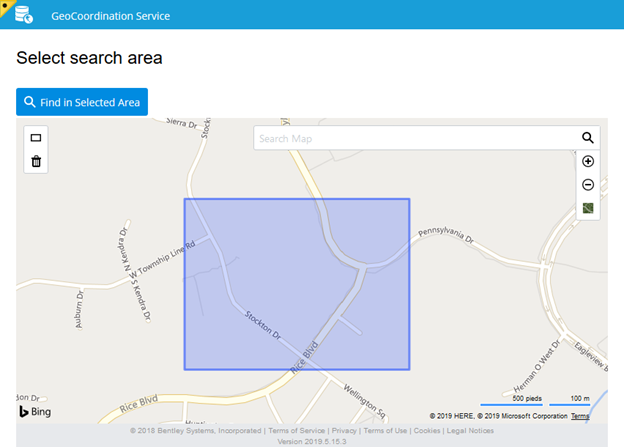
Setting Description Define Draw the shape of the search area on the map. Delete Delete the search area from the map. Search Map Type name of a location to navigate to in the map. Zoom In Zoom in on the map. Zoom Out Zoom out on the map. Switch Layer Toggle between "Roads" and "Aerial with labels" Bing Maps layers. - Use the portal's tools to define a search area.
- Click the Find in Selected Area button to query the GeoCoordination Service.
-
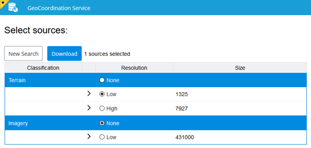
Select Terrain and Imagery data and click the download button.
Setting Description New Search Move back to the map view to define a new search area. Download Start downloading the selected Terrain and Imagery data. - Close or minimize the opened browser window.
-
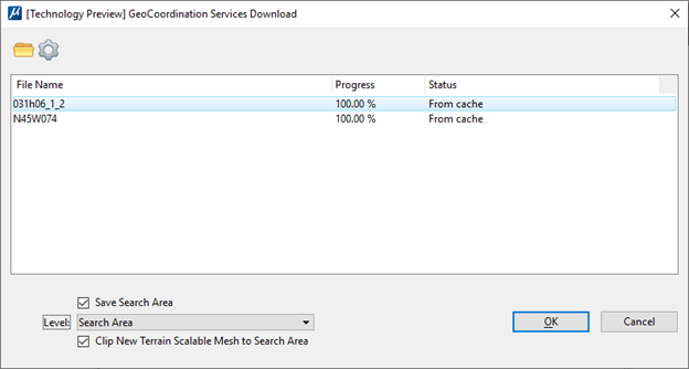
The GeoCoordination Services download dialog tracks download of
the data selected in the GeoCoordination Service portal.
This dialog is opened along with the GeoCoordination Service portal when clicking the GeoCoordination Service Download tool in the Scalable Mesh Elevation Source Editor dialog. Options in this dialog can be modified before starting downloading form the web portal.
Setting Description Open XRDP file Open an XRDP file to download results of a previous GeoCoordination Service search. Select download folder Select the folder where the GeoCoordination Service will download Terrain and Imagery data. Save Search Area Toggle ON to the search area drawn in the GeoCoordination Service portal as an element in the DGN file. Level Select a level where the search area element will be created.
Clip to Search Area Add the level selected in the Level list to the new Terrain Scalable Mesh as a clip source.